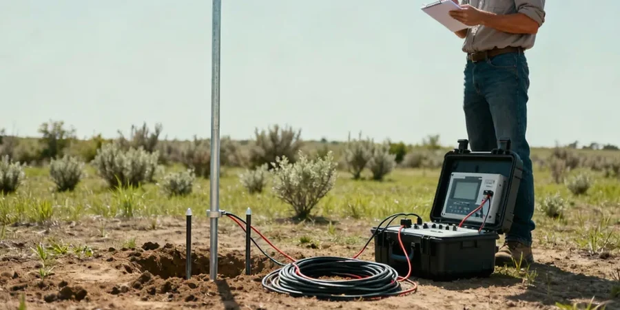
Athlone’s strategic position at the crossing of the River Shannon has shaped its development from an early Norman settlement into a key Midlands transport hub. The same river that brought trade also deposited a complex sequence of alluvial silts, peat lenses, and glacial tills beneath the town, making subsurface characterisation anything but straightforward. Standard intrusive investigation often struggles with the high water table and variable organic content found here, which is where electrical resistivity methods become indispensable. By injecting a controlled current into the ground and measuring the potential difference, the technique maps changes in subsurface resistivity without disturbing sensitive floodplain deposits. A vertical electrical sounding (VES) campaign can distinguish between water-saturated gravels, compact till, and the underlying Carboniferous limestone bedrock that controls foundation conditions across Westmeath. For projects ranging from bridge abutment assessments to mapping leachate plumes near former industrial sites, the method provides a continuous profile that boreholes alone cannot deliver.
A VES array across the Shannon floodplain can track the buried rockhead profile with vertical resolution under 2 metres, even through 20 metres of saturated drift.
Service characteristics in Athlone
Demonstration video
Risks and considerations in Athlone
The Midlands climate delivers over 900 mm of rainfall annually, keeping the Shannon floodplain near saturation for much of the winter. High pore-water pressure and lateral groundwater flow through gravel lenses can create resistivity ambiguities where a low-resistivity zone might be mistaken for clay when it is actually clean sand with conductive pore fluid. In Athlone, abandoned mill races and buried drainage culverts from the 19th-century woollen industry introduce additional anthropogenic noise that distorts the electric field if not identified beforehand. A desk study of historical maps and utility records is therefore as important as the geophysical survey itself. Without it, a VES inversion may misinterpret a brick-lined culvert as a bedrock high, leading to misplaced boreholes and costly redesign. We mitigate this by running reciprocal measurements and repeating soundings at orthogonal azimuths whenever the apparent resistivity curve shows an abrupt slope change that does not fit the expected three-layer glacial model.
Our services
Resistivity surveys in Athlone address three recurrent challenges facing developers and environmental consultants in the Midlands.
Bedrock profiling and rippability assessment
VES soundings spaced along proposed road alignments or building footprints delineate the limestone rockhead surface, identifying karst features and soft zones that affect piling design and excavation costs.
Groundwater exploration and well siting
Resistivity contrasts between water-bearing fractured limestone and tight mudstone help position production wells away from saline or turbid zones, particularly relevant for agricultural and distillery supply in the Athlone area.
Contaminant plume mapping
Leachate from historic landfills or fuel storage depots alters pore-fluid resistivity; time-lapse VES surveys track plume migration through the shallow alluvium toward the Shannon, supporting EPA compliance reporting.
Frequently asked questions
How deep can a VES survey investigate in Athlone’s glacial soils?
With a maximum current electrode spacing of 200 metres, the effective depth of investigation reaches approximately 40 to 60 metres below ground level. That range passes through the entire Quaternary sequence and well into the Carboniferous limestone beneath the town, which is sufficient for most foundation and groundwater studies in the area.
What does an electrical resistivity survey cost for a typical Midlands site?
A VES campaign with four to six sounding points, including data processing and a geophysical report with interpreted sections, generally falls between €630 and €860. The exact figure depends on access conditions, electrode array length, and whether the survey needs to be combined with other methods like seismic refraction.
Can resistivity distinguish between peat and soft clay in the Shannon floodplain?
Yes, and that distinction is critical for road embankment design. Fully saturated peat typically shows resistivity values below 20 Ωm, while soft glaciolacustrine clays often fall in the 25 to 40 Ωm range. The difference is subtle but resolvable with a dense Schlumberger expansion curve, especially when calibrated against a single borehole or CPT log.
Do buried services interfere with electrical resistivity measurements in urban Athlone?
Metallic pipes, reinforced concrete culverts, and high-voltage cables all distort the electric field and can produce false anomalies in the inverted section. We always consult utility records before fieldwork, maintain a minimum offset from known linear features, and when necessary rotate the array azimuth to test whether an anomaly persists – a quick way to separate geology from infrastructure noise.