Athlone sits right on the banks of the River Shannon, and the ground here has a story to tell. Glacial tills and alluvial deposits dominate the subsurface, with water tables that sit uncomfortably close to the surface for anyone planning a basement or a deep services trench. The geology is a layered legacy of the last ice age — stiff boulder clays overlying limestone bedrock, but laced with pockets of soft silt and sand lenses that can turn a straightforward dig into a messy problem. Getting the geotechnical design right for a deep excavation here isn't just about shoring calculations; it starts with understanding how the river and the glacial history have conspired to create some very localised ground conditions. A proper site investigation with CPT testing can map these soft spots before a single bucket hits the soil, and it makes all the difference when you're working within a few metres of neighbouring properties in the town centre.
In Athlone, the ground can look forgiving and then catch you out in a single wet spell — the design has to assume the worst lens of silt is lurking right behind the shoring.
Service characteristics in Athlone
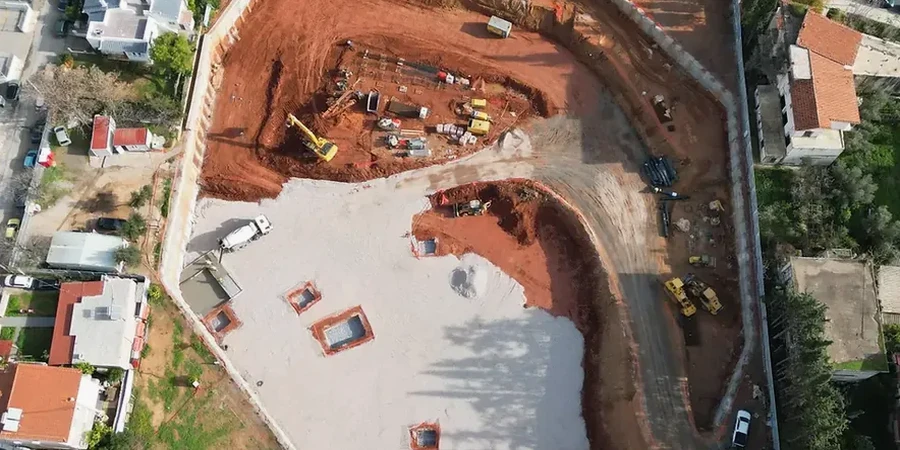
Risks and considerations in Athlone
IS EN 1997-1:2004 requires that deep excavations be treated as Geotechnical Category 2 or 3 — and for good reason in a place like Athlone. The combination of high groundwater, variable glacial deposits, and tight site access creates a risk profile that a simple prescriptive rule can't cover. A basal heave failure in a soft silt layer, or a sudden inflow through an undetected sand lens, can escalate from a construction delay into a structural emergency for the building next door. The river's influence means pore pressures don't just sit there; they respond to seasonal flooding and heavy rainfall with a lag that can catch a dewatering system off guard. That's why our designs build in observational method protocols — if the piezometers show a pressure spike, the contractor already has a pre-approved contingency plan, not a panicked phone call on a Friday afternoon.
Our services
The technical approach we bring to Athlone jobs covers the full lifecycle of the excavation, from initial ground modelling through to construction support. These three service areas form the backbone of our deep excavation practice.
Excavation Support Design
We prepare detailed designs for sheet pile walls, secant piles, and soldier pile systems, calibrated to the stiff tills and high water pressures typical of the Athlone area. Each design includes staged excavation analysis so the contractor knows exactly when to install props or ground anchors.
Groundwater Control Plans
With the Shannon so close, managing hydrostatic pressure is non-negotiable. We develop dewatering and cut-off strategies using wellpoint systems or deep wells, backed by permeability testing and seepage modelling to keep the base of the dig dry and stable.
Settlement & Monitoring Specifications
Deep digs in Athlone's urban fabric can't afford surprises next door. We set out trigger levels and instrumentation arrays — inclinometers, settlement markers, piezometers — so the site team gets early warning of any ground movement and can act before damage occurs.
Frequently asked questions
How much does a geotechnical design for a deep excavation in Athlone cost?
The fee for a full geotechnical design package — including ground investigation interpretation, shoring design, dewatering plan, and monitoring specification — generally runs between €1,710 and €6,960 in the Athlone area. The spread reflects the depth of the dig, the proximity to the Shannon, and the complexity of the shoring system needed. A simple 3-metre service trench on a greenfield site will be at the lower end; a 10-metre basement next to a protected structure will sit at the upper end.
What ground investigation data do you need before starting the design?
We need a site-specific ground investigation that includes boreholes with SPTs, laboratory classification and strength tests on undisturbed samples, and groundwater monitoring over at least a few weeks. For Athlone sites near the river, CPT profiles are especially useful for picking out thin silt and sand seams that a standard borehole log might miss. Without this level of detail, any deep excavation design is just guesswork.
How do you handle the risk of flooding from the River Shannon during a deep excavation?
Flood risk is built into the design from day one. We model the excavation for the 1-in-100-year flood level plus a freeboard allowance, and the shoring and dewatering systems are checked under those hydraulic loads. In practical terms, this often means designing a cut-off wall that extends into the low-permeability till below the alluvial sands, so even if the river rises, water doesn't simply bypass the shoring through a deeper permeable layer.
What monitoring is required during a deep excavation in Athlone town centre?
For urban digs, we typically specify inclinometers in the shoring, piezometers at multiple depths to track pore pressure, and precise levelling points on adjacent buildings and pavements. Readings are taken at a frequency tied to the excavation stage — daily during active digging, reducing to weekly once the base slab is cast. The monitoring plan includes amber and red trigger levels so the contractor has clear thresholds for slowing down or stopping work.